Location Assessment Software
Location Assessment and Sales Forecast Made Easy with the Software from WIGeoGIS
Would you like to create a location assessment for planned branches, but have no specialist knowledge of geo-information systems? No problem, with WIGeoLocation you can get reliable sales forecasts at the push of a button.
Sales Forecasts Made Easy with WIGeoGIS Software
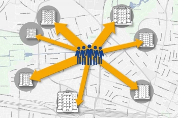
With the gravity analysis according to Huff, you can perform location assessments and create reliable sales forecasts. Gravity analysis? That sounds complicated? Can something like this also be prepared without specialist knowledge of geographic information systems (GIS)? Yes!
Preparing a gravity analysis requires absolutely no expert know-how with WIGeoLocation, the web-based software from WIGeoGIS. Within seconds, you can prepare a report with the sales forecast for a planned location as well as detailed information on how a new location would affect the sales of existing locations in the vicinity.

Advantages of Location Assessment with WIGeoLocation
- Create sales forecasts for planned locations in seconds
- Predict the impact on the sales of existing locations if you or a competitor opens or closes another branch in the vicinity
- No GIS expertise required
- Automatic calculations according to the Huff gravity model
- Runs in your web browser (no software installation required)
- Automated and standardized reports of the current location assessment are created within seconds
Gravity Analysis with WIGeoLocation: Live Demo Free & with No Obligation
A location assessment with WIGeoLocation is as easy as can be
The WIGeoGIS team integrates the additional gravity module, configures the settings in WIGeoLocation once based on your individual requirements, incorporates the correct data into the program and calibrates the Huff gravity model for you. After that, you can log in at any time via your browser and assess planned locations, the effects of location closures or relocations and the effects of new competitor locations on your sales with just a few clicks of the mouse.
This is how it usually works:
- You enter the location address or mark the planned location on the map.
- You select the catchment area from which you expect customers and set a travel time for them to reach your location, for example up to 10 minutes.
- Now enter the attractiveness of the location and click on "Request location report".
- The program performs a Huff gravity analysis in the background and in a matter of seconds you will receive the report on the location assessment.
- Now you know how much sales potential your new location has and how it will affect the sales of existing locations.

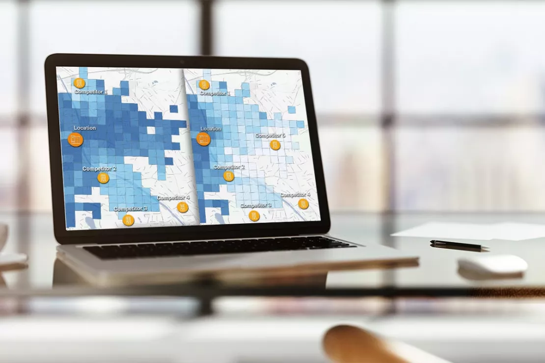
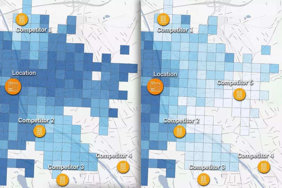
2 examples of location evaluation using gravity analysis. On the left, you determine your sales potential based on the existing competitive situation. On the right, you can see the changes in your sales potential if a new competitor (Competitor 5) were to locate to the east of your site. The GIS software WIGeoLocation evaluates at the push of a button.
My Data, your Data
In a gravity analysis, the quality of the location assessment depends primarily on the quality of the data that is entered into the software. It is therefore important to enter high-quality data on the defined attractiveness parameters of the locations, including both your own and that of your competitors.
WIGeoGIS provides the location data on the number of residents in the respective catchment area and their purchasing power as well as the calculations of the distances between locations and customers. On the user side, local know-how is beneficial in order to be able to assess the attractiveness of existing locations as well as the possible attractiveness of a new location. This makes the location assessment and sales forecast even more reliable.
This is How the Gravity Analysis Works for Your Location Assessment
QGIS – The Alternative for Experts
For companies with their own GIS experts, WIGeoGIS offers QGIS-Software with a suitable gravity plug-in for gravity analysis according to Huff. QGIS is installed on your company computer and enables your GIS experts to use the Huff model quickly, easily and efficiently without doing the calculations themselves. Your in-house GIS experts only enter and calibrate the parameters for the Huff gravity analysis. If a recalibration is necessary, you can also do this yourself.
You Can Find Out More About the Software and Further Information on Gravity Analysis and Sales Forecasting Here

Perform a Location Assessment Using a Gravity Analysis
Gravity analysis provides a well-founded basis for your location assessment and sales forecasts.

WIGeoLocation: WebGIS software for location analysis
WIGeoLocation is the modern WebGIS software for location analysis. Your location report in just 3 minutes.
Gravity Analysis Software: Request a FREE Live Demo!
- FREE Live-Demo* of Gravity Analysis
- Non-binding, without further obligations
- Online presentation via video call
Do you want to know more about our gravity analysis software? I will be glad to support you.
* The products of WIGeoGIS are intended for companies and are not suitable for private use. If you need a one-time market analysis, we will gladly make you a service offer.
FAQ
-
How long does it take before I can prepare my first gravity analysis reports?
This can be done very quickly with WIGeoLocation. The WIGeoGIS team can often incorporate the data and perform the basic calibration within a week. As soon as this is done, users can create automated reports at any time with just a few clicks in the browser. If you use QGIS, the software for experts, you first need several days of basic training in order to be able to perform the calibration yourself. Theoretical previous knowledge of Huff's gravity model is helpful.
-
What if the sales forecast does not seem realistic?
It may be that the basic settings were too optimistic or too pessimistic. In order to make the analysis more accurate in such a case, we at WIGeoGIS can recalibrate the models based on sales data and thus react dynamically to changes in the market. Basically, the following applies in any case: The better your regional knowledge of the planned location, the more accurate the sales forecast in the WIGeoWeb or QGIS software.
-
For whom is the add-on module for gravity analysis worthwhile?
Companies that have several branches or locations and where the network of locations is constantly changing can benefit greatly from the gravity analysis software from WIGeoGIS. Even companies that sell their products through partners in brick and motor retail (such as milk, cosmetics or shoe manufacturers) can significantly improve and simplify their location planning using the gravity analysis in WIGeoWeb or QGIS. Companies with only a handful of branches and no expansion plans will likely have no need for gravity analysis software.
-
For whom is WIGeoLocation suitable and for whom is QGIS better?
The add-on module for gravity analysis in the web-based GIS software WIGeoLocation is suitable for those companies that do not have any specific expertise in geographic information systems (GIS) and do not want to invest in acquiring it. For GIS experts, however, QGIS, the desktop version of the software, is recommended.
We would be happy to give you a live demonstration of how Gravity Analysis for Location Assessment works!

