QGIS Software: What Advantages Does It Offer?
QGIS is the Basis for Geo-Analytics on Desktop Systems
QGIS is the right decision for your GIS software with all the advantages of open source software. WIGeoGIS offers a solution package based on QGIS with extended functions developed especially for companies, as well as technical and professional support to meet your specific needs.
QGIS: Free Open Source Software for Desktop GIS
- Operating system: Windows, Mac, Linux
- Features: Data visualization, mapping, data manipulation, data management, analysis tools
- Expansion through plugins
- WIGeoGIS Plugins: WIGeo QGIS, Geocode Plugin, ATP Territory Planning, Huff
- Users: GIS and geomarketing experts
- Training: is recommended / WIGeoGIS offers individual training online or on-site
- Download
An Overview of the Key Points
QGIS Software, Market Data, Digital Maps - Expertise from a Single Source
- QGIS is a user-friendly GIS software that is used around 800,000 times a day worldwide.
- Since QGIS is an open source GIS software, there are no license costs.
- With QGIS, you can easily create digital maps and visualize your data, edit spreadsheets and create layouts of your analyses to be included in your presentations.
- The desktop software runs on the operating systems Windows, Linux, Mac.
- The GIS software supports a variety of geodata formats and functionalities.
- QGIS is modular and open.
With WIGeo QGIS, WIGeoGIS extends the QGIS software with a plugin that has numerous functions specifically tailored to geomarketing. Through the combination of market data, digital maps and additional functions, this solution provides the best basis for your analyses.
Curious what QGIS can offer your business? Contact us for more information!
Helpful Facts About QGIS and the WIGeoGIS Products & Services
What Does the QGIS Software Offer?
QGIS is a comprehensive GIS software with numerous functions and a wide range of possible uses for companies. Collect, process and analyze your spatial data.
QGIS is a free software. At the same time, it is complex to use and often requires prior GIS knowledge or support from experts. Simplify your work processes with QGIS and get advice from the WIGeoGIS team if needed!
If you do not find all the functions you need in QGIS, WIGeoGIS also offers QGIS-plugins for your geomarketing data analyses, which also make it easier to use. We also develop individual extensions for your specific needs. Our offer covers the entire range of geographic analyses.
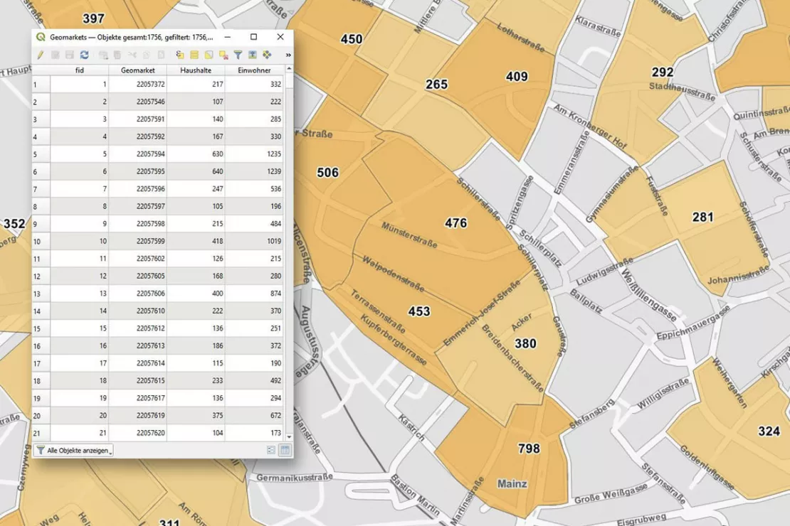
User-Friendly GIS Software
- Analyze data spatially + display it on digital maps
- Use a variety of symbols to highlight specific information
- Label comprehensively
- Automate recurring analyses (e.g. location analyses)
- Enhance presentations + reports
- and much more ...
Market Data and Geodata
A GIS without data is worthless. With QGIS you can:
- Integrate different data
- Visualize and query data
- Analyze data
- Edit, manage and export data
- Create map layouts and reports
QGIS supports numerous geodata formats
- PostgreSQL/PostGIS database
- Oracle Spatial database
- Esri FileGDB
- Esri Shapefile, MapInfo, GML
- Approximately 70 raster formats for height models, aerial images and satellite images
- OGC compatible: WMS, WMTS, WFS...
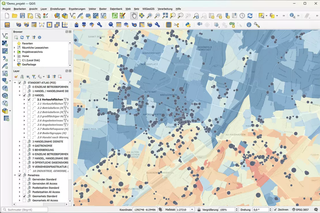
QGIS offers extensive visualization options: You can visualize and evaluate market data, location data and much more in a way that is visually appealing
We would be happy to show you WIGeo QGIS, the geomarketing plugin for QGIS, and to provide you a free initial consultation!
What is the QGIS Community?
“QGIS has been around for more than 20 years and is the most widely used open source GIS. The community is growing continuously, with developers and user groups on every continent,” says GIS specialist Anita Graser, who, in addition to her main job as a senior scientist at the Austrian Institute of Technology (AIT), is also one of the three board members of QGIS.
The QGIS community updates the software regularly, releasing minor updates every few weeks and major updates once a year.
There are active user groups in many countries that are constantly developing QGIS, for example in Peru, Brazil, Canada, Portugal, Kenya, Germany, Austria, Georgia, Japan, New Zealand and Australia. The group of users is still significantly larger than that of developers: QGIS is accessed around 18 million times a month.
Greenland and Iceland are among the countries where QGIS is most widely used, measured per capita. QGIS is also very popular in Portugal, Australia, Spain, Germany, Austria and Poland. In absolute numbers, France, Brazil, Germany, India and Italy are among the heavy users. You can find more statistical material on the QGIS website.
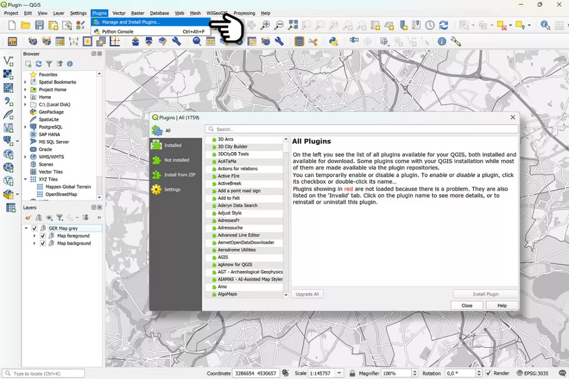
What are QGIS plugins?
QGIS is like a blank sheet or an empty file: The true value of the GIS software only becomes evident through practical use, data input, and the skillful application to answer specific questions. Plugins play an important role here.
“Plugins make it possible to customize and expand the functionality of QGIS. The plugin repository contains over 2,200 plugins for a wide variety of needs, from data catalogs and analysis tools, to exporting 3D visualizations.”
Anita Graser, QGIS Board Member
This shows: QGIS is a software for experts. That is why WIGeoGIS has developed the WIGeo QGIS plugin with many important additional functions for use in geomarketing. This means that even people with no QGIS expertise can perform location analyses, target group analyses, market analyses and sales network planning in QGIS.
Do you want extended functionality, training or technical support for QGIS? Our experts are here for you!
How can I support the QGIS project?
If you want to do more than just use QGIS, there are numerous options to actively contribute to its development.
According to QGIS board member Anita Graser, interested parties can, for example, join the Austrian user group, attend the annual German-speaking FOSSGIS conference and the international QGIS User Conference, follow the monthly live-streamed QGIS Open Days on YouTube or various groups in social media, and of course you can also contact professional support providers such as WIGeoGIS. By the way, Anita Graser regularly posts interesting facts about the developments at QGIS on her blog.
For users who would like to support the open source project QGIS financially, you can do so with a donation or a membership. WIGeoGIS is also part of the community supporting QGIS members. This allows QGIS to fund infrastructure, conferences, workshops and development meetings.
What does WIGeoGIS offer for QGIS?
Would you like to use the open source software QGIS for your business processes? WIGeoGIS supports you with offers from plugins to QGIS training and individual consulting.
Additional Functions for QGIS: Save Time, Nerves and Costs
Based on our decades of experience, we have expanded the features of the QGIS software with numerous functions and developed WIGeo QGIS. This makes your location analyses, target group analyses and market analyses in QGIS much easier.
Thanks to the numerous functions of the WIGeo QGIS plugin, you can conduct automatic location assessments in QGIS, assess locations and areas according to self-defined criteria and create hotspot analyses.
Individual QGIS Training and Technical Support
Do you want to make use of all the functionalities in QGIS that are important for your business? Then book your individual QGIS training with the experienced QGIS experts at WIGeoGIS.
Do you need support with a specific problem in QGIS? Contact the WIGeoGIS team! We will be happy to provide you with technical and professional support.

Video Tutorials for QGIS
You can also find numerous tutorials for our QGIS plugins on our YouTube channel. For example, you can learn:
- How to display your customer data in QGIS
- How to calculate the cannibalization effect of two locations in QGIS
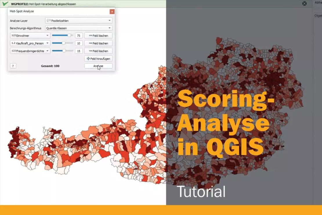
- How to create a scoring analysis in QGIS and identify the hotspots with high potential.
- How to create a potential analysis for the smallest spatial units using raster data in QGIS
QGIS for Your Business: Benefit from Our Expert Knowledge
Learn how you can optimally benefit from the QGIS offer from WIGeoGIS for your company in the expert interview with Josef Mayer, who has been working with QGIS since 2012.

Do you need help getting started with QGIS and finding the right plugins? We are happy to help you!
Using QGIS in Your Business: Request a free initial consultation
- FREE initial consultation* on our QGIS offers
- Non-binding, without further obligations
- By telephone or video call
Do you need help getting started with QGIS and finding the right plugins? I will gladly support you. Please contact me!
* The products of WIGeoGIS are intended for companies and are not suitable for private use. If you need a one-time market analysis, we will gladly make you a service offer.
This might be relevant for you:

Why Geomarketing?
Geomarketing allows you to identify your market potential and plan your expansion, sales and marketing activities. WIGeoGIS provides comprehensive support.
The Basics of GIS and Geoinformatics
What is a GIS? What is GIS software used for and what do you need to use it? Let us explain the basics.

Discover the Potential of Location Intelligence
With Location Intelligence, you analyze your data spatially and visualize it on a digital map. This helps you to make smart strategic and business decisions.
FAQ
-
How long does it take to learn QGIS?
Getting started with QGIS depends on your previous knowledge and your area of application. In simple terms, we can say:
- If you have never worked with a GIS software before, you can learn the basic features of QGIS in 1-2 weeks if you work with it for a few hours a day during that time.
- In order to master the advanced functions, you will need a few months of regular practice.
We definitely recommend the appropriate training courses to optimize your training time. You can find our selection of training courses here.
-
Where can I get current data for QGIS?
There are now a wealth of sources for geodata and market data. Numerous private and public providers make the data available in the appropriate formats. WIGeoGIS offers ready-to-use market data and geodata. For further information, see Overview of Geodata and Market Data or request a free initial consultation.
-
How can I support the QGIS project?
For companies or organizations, these are the best ways to provide support:
- Companies and organizations can support the project through donations. Donations help to finance the infrastructure and promote development. Click here to learn more.
- Companies can help expand the know-how of all users by sharing knowledge and experiences in forums, workshops and lectures.
- Report any bugs you find and give feedback on new features. This helps to continuously improve QGIS.
Of course, you can also help with the further development, testing and documentation of the QGIS software.
-
How can I expand QGIS functionally?
QGIS development is mostly done using Python. This allows you to expand QGIS functionality and automate processes. This is usually done in the following ways:
- Python Console: QGIS has a built-in Python console. Here you can enter and execute Python commands directly.
- Scripting: You can create scripts to automate recurring tasks.
- Python Plugins: Similar to QGIS plugins from WIGeoGIS, custom plugins can also be developed and integrated into QGIS.

