GIS - What is That?
Geo Information Systems - An Introduction
It refers to GIS software, GIS tool or Geographic Information Systems. Still confused? On this webpage we will explain all the basics like what a geographic information system is, what it is used for, how it works and most importantly, how it can help your business grow and succeed!
This is what you can expect on this page
GIS Software - Briefly Explained
GIS software processes spatial information. It can
- capture
- organize/reorganize
- save
- process
- model
- visualize (geographically on digital maps) and
- analyze
spatial data. The information obtained is used to control processes and help make better decisions.
GIS stands for Geographic Information System
It describes the whole system, which like any IT system consists of:
- software
- hardware and
- data.
The prefix Geo- (Greek) means earth, or in other words space.
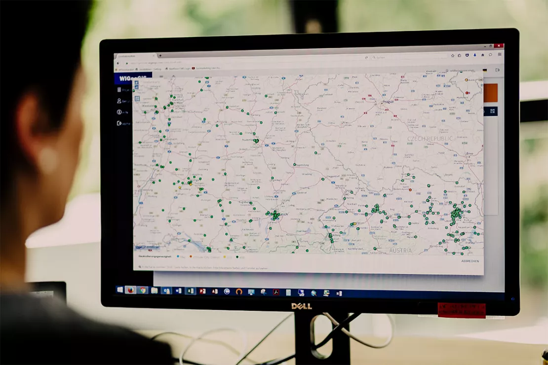
GIS Software is the Tool for Geoinformatics
“A GIS is the tool for geoinformatics, just as a word processor is used for writing and spreadsheets are used for calculating and processing numbers.”
Univ-Prof. Dr. Josef Strobl, Head of Interfaculty Department of Geoinformatics – Z_GIS, University of Salzburg
What are GIS and GIS Software Used For?
What is geoinformatics all about?
Let’s take a brief moment to explain.
Geoinformatics is, to put it simply, computer-aided geography. At least it was developed from geography. And geography is a special discipline in that it basically concerns almost everything.
No ;-), that’s not entirely true. But geography, unlike other sciences, does not study a particular category of objects, such as biology studies living organisms. It is an integrative science that explores the human-space-environment relationship.
It Is Always About the “Where?”
“Geography is concerned with all objects, but the perspective is always the space and its organization. In that sense it is like history, in which the perspective is time. Therefore, geography and geoinformatics are very interdisciplinary domains. This often confuses people when they try to assign certain scientific objects to geography."
Univ-Prof. Dr. Josef Strobl, Head of Interfaculty Department of Geoinformatics – Z_GIS, University of Salzburg
Our reality consists of space and time. We always move in space. This also explains why it is almost impossible to narrow down the areas in which GIS tools are used. That said, here is a small list:
- Public and State Administration
- Military
- Everyday Life
- Science
- Industry
- Business
We will focus on the business applications. But first, here are some examples of GIS applications in other areas:
Public Administration:
Supply networks: electricity, gas, water, etc.: land registers help the administration with the allocation of fees, the repair of supply lines, in emergencies (e.g. fire hydrant plans for the fire department) and much more.
The Breitbandatlas Österreich is a map of Austria that shows the current state of broadband coverage for every Austrian address that is easily accessible in a browser.
Geoinformation systems monitor the water circulation of a country including the data on precipitation, runoff, sources, etc.
They show in which regions the energy usage of the industry is highest and which energy sources are used.
The Atlas Agrarstatistik contains small-scale data on the structure of agriculture in Germany.
Catastrophe protection: calculate risk maps and show how endangered a property or house is for events such as floods, earthquakes or storm damage. The public sector is not the only one to use GIS for such things, insurance companies of course also use GIS for the same purpose. GIS answers such questions as, “Show me all the houses that would be damaged in the event of a 100-year flood.”
Everyday Life:
The route planner shows the fastest or shortest route, taking into account individual filters (e.g. no tolls), shows how long the journey will take and offers additional functions such as displaying all gas stations or rest stops along the route.
The app for public transport shows when the next express train leaves, etc.
We would be happy to give you a live demonstration of how GIS Software works!
GIS Software in Business: Geomarketing
Geomarketing is the application of GIS software and spatial analysis in the corporate environment.
Some consider the term to be an unfortunate choice and prefer to say business geographics. There is something to that, because geomarketing is actually much more than just marketing.
Business geographics provides benefits for control and decision-making in every area of the company. Internal and external business data are located and linked in such a way that decisions are prepared and supported.
Geomarketing is business intelligence with a spatial reference.
The most important and common areas in companies that benefit from GIS applications are:
- Sales
- Marketing
- Controlling
- Expansion / Location Management
- Management / Corporate Management
A few examples of questions a GIS tool can answer:
Sales optimization: You have 5 sales areas and 5 sales representatives and want to revise your area planning. The employees have very different sales figures, so it is obvious some are not very motivated. An employee retires and you are trying to decide if you need to fill the position again or if you can get by with just 4 sales representatives.– The GIS recalculates the areas, dividing the sales potential so that it is balanced, optimizing the routes and taking into account the employees’ places of residence. With the push of a button you can play through different scenarios with 4 or 5 sales areas.
Logistics: You have 2 bakery locations from which you supply 14 supermarkets. The GIS calculates the optimal routes and shows you how many vehicles you need.
Locations: You are a chain store operator who wants to enter a new market. You want to open around 10 stores. The GIS shows you where these locations should be. If you have already considered several properties for a location, the GIS calculates which of them has the greatest potential.
Catchment Area: Catchment areas that are drawn like a circle around a location (= as the crow flies) do not provide much information in practice. A GIS realistically calculates catchment areas based on the road and path network according to distance or time.

Meaningful Catchment Areas
1 Distance polygon based on the road network, here 5 km by car.
2 As the crow flies 2 km circle: Accessibility does not take into account the road network or natural barriers such as rivers or mountains.
3 Time polygons for different means of transport (car, truck) and pedestrians, here a 10-minute walk. The river is taken into account as a barrier.
See also the Bing Maps Online Service “Isochrone API”
More information on common GIS analyses:
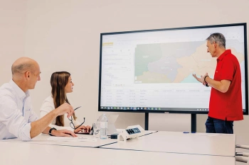
Sales Territory Planning
You want to plan, evaluate and divide sales territories for your sales representatives? Here are the key reasons why geomarketing software makes sales and territory planning more efficient.
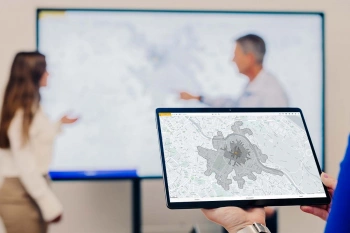
Location Analysis
WIGeoGIS supports your location analysis with extensive consulting know-how and geomarketing software. This allows you to efficiently assess your branch and retail networks.

Market Analysis Tool
How to successfully perform 6 different analyses. Anyone who does business, must know their market. WIGeoWeb helps to answer the question of WHERE.
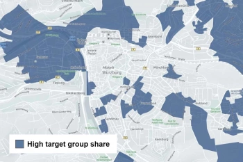
Target Group Analysis and Geomarketing
Target group analysis with geomarketing reveals regional potential and its distribution.
For specific examples, take a look at our success stories.
Which industries are GIS applications suitable for?
As we said above, our world consists of space, and this is true for everyone. Market potential has to be determined and managed in every industry, customers in every business want a clear analysis and overview.
But every industry has its special requirements. We have compiled information on GIS tools for you by industry:
Retail
Real Estate
Manufacturers and Industrial
Media Planning and Advertising
Banks and Financial Institutions
Pharmaceutical and Healthcare Industry
5 Reasons Why GIS is Worthwhile for Every Company
- Recognize at a glance relationships that otherwise remain hidden
- Better, faster and more accurate decisions on an objective basis with the help of GIS analyses
- More efficiency ⇒ cost savings
- Business analyses can also be carried out regionally and on a small scale better with GIS than any other tool
- Manage data efficiently and share it between all your departments
How Does GIS Work and What Do You Need to Use It?
A GIS is an interactive map enriched with functions.
The data is organized in information layers and can be shown and hidden, i.e. filtered, and combined with one another. This visual preparation of the data as locations on a map is on its own enough to draw conclusions. Relationships become clear in seconds that would otherwise be impossible or require a great deal of time to recognize by other means such tables. (Watch our video with a self test.) This part of the analysis is conducted, so to speak, with the brain and the eye. Think of a map that shows you the distribution of your customers by their billing address. You can see immediately where you have many customers and where you have few, which is not the case with a list or table.
In addition, numerous functions (see example catchment areas above) can be programmed into the software. The GIS then delivers the finished results and calculations, not just on a map, but also for example as a table that can be exported.
As already mentioned, every IT system consists of software, hardware and data. Let’s start with the data.
1. Data
Geodata: Raster Data and Vector Data – Two Data Models
A GIS needs a digital map as a basis. The map provides the geodata. It forms the basis for the presentation: cities, streets, rivers, etc. Of course, they do not have to be redrawn every time. You can buy geodata, for example from large providers such as Microsoft or TomTom, or you can use open-source material (OpenStreetMap).
Geographic information systems work with two different data models:
In the vector data model, the map is made up of points, lines and areas (polygons) that are defined by vectors. In addition to their geometry, these objects also have attributes. The map is “drawn” using the objects and graphic elements such as color or halftone, symbols and text.
In the raster data model, the map consists of cells arranged in a matrix of rows and columns. An area, for example a forest area, is represented here in that all the cells within the area have the value “dark green”. An aerial photograph or satellite image consists of raster data (pixels).
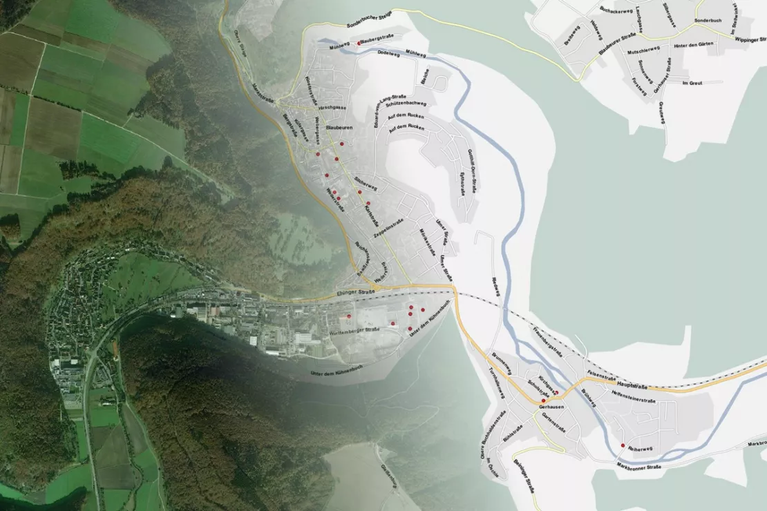
Left part of the picture: The aerial photo as an example of a raster data set. The color of the pixels is the information. Right part of the picture: The continuation of the section as a vector data set. The map is drawn with lines, points and polygons.
Each Data Model Has Its Strengths
“The dichotomy goes back to the beginnings of geoinformatics, which developed on the one hand from the endeavor to draw maps automatically, this is how the vector data model came about, and on the other hand from remote sensing. Aerial and satellite images are already digital and consist of pixels, i.e. raster cells.”
Univ-Prof. Dr. Josef Strobl, Head of Interfaculty Department of Geoinformatics – Z_GIS, University of Salzburg
Anyone who has already switched from the standard to the satellite view in their route planner knows the difference. The two data models differ significantly both technically and in terms of functionality, for example in the memory requirements and the algorithms used.
With raster data, information in areas can be shown in great detail. In geomarketing, the vector data model is of greater importance, as the objects can be linked more directly to a variety of different attributes.
More on Geodata.
Company Data and Demographic Data
A GIS tool is more than just a digital map. It only becomes exciting when you feed the system with additional data, link it and ask questions.
A simple example from everyday life: You can display all the gas stations or pharmacies along your route in the route planner. To do this, the gas stations and pharmacies must first be entered into the system’s database!
On the one hand, existing internal company data is used in geomarketing: customer data, sales data, KPIs, location data, etc. 80% of all company data has a spatial reference and this is why geomarketing works so well.
In order to be able to carry out GIS analyses, additional external data are often required. This data includes demographics, potential data and much more. Example: You first display your existing customers (= internal data) geographically on the map. Then you link them with data for target groups and market potential (= external data). From this you draw valuable conclusions on how you can control your sales and generate more sales.
The quality of the data determines the quality of your analyses. But market data is often not free. The selection of the right data requires a lot of know-how.
More on Demographics.
Which market data is the right one? We know the providers and give you unbiased advice.
2. Software
Geocoding: Providing Data Sets with Coordinates
One of the basic functionalities of GIS software is geocoding: The market and company data must be assigned a pair of coordinates (longitude, latitude), otherwise they cannot be located and visualized on the map. There is GIS software that does exactly this, e.g. if large amounts of address data have to be geocoded.
Choosing the Right GIS Software
However, not every GIS has geocoding already integrated. If you want to use your GIS software in business for geomarketing, it is best to choose software that has been specially developed or adapted for this.
The general trend of using software online in a cloud and browser-based manner has also come to GIS software. A modern, universal GIS tool for geomarketing
- runs in a browser (can also be used on the go on a tablet)
- is easy to use without having to be a GIS expert
- is designed for all common questions of business geographics.
Our own software portfolio, the result of 25 years of geomarketing experience, reflects what such a GIS must be able to do and which special products are still useful: In addition to a universal WebGIS for geomarketing, we offer software specifically for location analysis, for sales territory planning and only for geocoding.
However, since many companies, especially small and medium-sized ones, do not want to jump right in with commercial software but prefer to use the open-source software QGIS, we offer the necessary support: QGIS is free and universal, but you need GIS know-how. In addition, QGIS was not developed specifically for geomarketing and cannot do everything that companies often need. Therefore, we not only offer support and training, we have also programmed the common geomarketing functions as extensions.
All the details about the WIGeo QGIS package.
We also support ArcGIS Pro users with special extensions tailored for geomarketing. ArcGIS Pro is a widely used commercial GIS software.
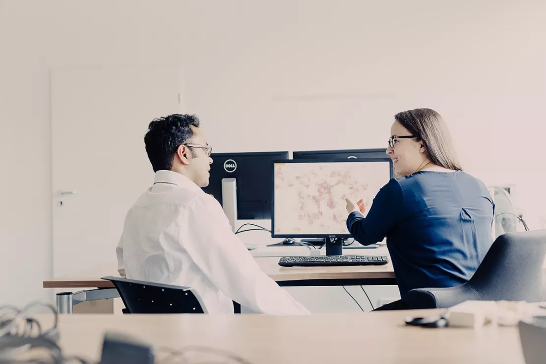
Software from WIGeoGIS
At a glance
- Universal GIS software for geomarketing
- Special software (locations, expansion, sales)
- Free test version
Universal WebGIS for business geographics? Try it out now!
3. Hardware
There is not much for us to say about hardware at this point.
Only this: In line with the trend of recent years, you basically decide whether you want to operate the hardware yourself or use an online service.
A WebGIS runs in the browser, the data and the software are in the cloud. Many geodata services are offered completely online. Read more about deciding to use the cloud or your own hardware.
4. Methods and Know-How
On the one hand, the methodology is of course part of the software. A GIS calculates the shortest route, the catchment area, etc.
On the other hand, it should be mentioned: the methods when working with GIS tools are also a question of know-how. As already mentioned, a good universal GIS for geomarketing performs frequent standardized tasks at the push of a button. The fact that you do not need any GIS know-how is what makes such a GIS stand out.
Complex, rare or special questions can still only be performed with GIS know-how and business knowledge. Many large companies employ one or more GIS experts for this. If that is not possible or profitable, you can address your GIS questions to external experts.
We know from our own experience: aside from the software, there are a plethora of methods. If necessary, we combine these with each other.
Conclusion and Who We Are
If you have read this far, allow us to do a little advertising here at the end ;-)
A summary of our portfolio reads like a list of what to think about when dealing with GIS software for geomarketing.
A GIS is an IT system that answers spatial questions. When it comes to questions in the business environment, one speaks of business geographics or geomarketing.
We have specialized in exactly that.
We offer software products that we program ourselves with everything that goes along with them: support, hosting, training. From universal WebGIS to software for special topics such as location analysis, territory planning and geocoding. Since it is often needed, we also offer support and additional functions for open-source software.
If necessary, we also program custom GIS software. You can find examples in our case studies.
A GIS tool is worthless without data. GIS analyses require not only geodata, but often also external demographics. That is why we support our customers in choosing the right data. This saves you work and guarantees a good price-performance ratio.
However, we are also a consulting company. We have an excellent team of business geographers. We are happy to take over your analyses and know all the tricks.
GIS Software: Request a FREE Live Demo!
- FREE Live-Demo* of GIS Software
- Non-binding, without further obligations
- Online presentation via video call
Do you want to know more about GIS software? I will be glad to support you.
* The products of WIGeoGIS are intended for companies and are not suitable for private use. If you need a one-time market analysis, we will gladly make you a service offer.
FAQ
-
What does “data with spatial reference”, spatial data or spatial information mean?
A data record has a spatial reference if it can be mapped geographically. The simplest example is an address: Sample street 1 in city XY. In order for the GIS to display the address, the data record must be provided with coordinates. This process is called “geocoding” because the street name and house number are not sufficient to be able to display the point on the map.
Locations such as hotels, gas stations, branch locations, etc. have a spatial reference, that much is clear, but trees, fire hydrants and cell phone masts also have a spatial reference. In the corporate sector, up to 80% of all data has a spatial reference, which is why business analyses with GIS are so good. An example is customer data and sales. Even if you sell everywhere online, your customers have a place of residence and your sales have a billing address. Displaying the distribution geographically enables you to draw valuable conclusions about your target group.
An example of a non-spatial topic would be describing a chemical reaction: Under certain conditions, ammonia is formed from nitrogen and hydrogen. In this case, it does not matter where the reaction takes place.
-
Is GIS software also worthwhile for small businesses?
If you want to enter the world of GIS analyses without having to think about which GIS software to use, we recommend a SaaS version of WebGIS (Software as a Service). We also offer our universal geomarketing software in this form, for example: The software runs on the servers in our secure data center, we take care of the technology and data and simply provide you access. You perform exactly the analyses you need. This is absolutely affordable even for small businesses.
-
Does the GIS already contain all the data?
A GIS consists of software, hardware and data. The software is just the tool, the data is like the ingredients in cooking. They are entered into the system locally or linked via an interface. Which data is used depends on the task at hand. Geodata (digital maps), demographic data and internal company data are used. The only requirement is that the data has a spatial reference.
-
Can I also analyze data from Excel with GIS?
Of course! The data is imported into the GIS, it just needs to include spatial attributes. A wide selection of formats can be imported ranging from classic geographic formats such as GeoJSON and Shape to universal formats such as CSV and XML.
-
Do you need GIS know-how in order to be able to use GIS software for geomarketing or business analyses?
No. We offer a wide range of solutions. With modern WebGIS products, frequent and recurring tasks, such as location analyses, can be carried out very easily “at the push of a button”. Users are experts from marketing, sales, expansion, controlling and corporate management who are well versed in their field, but not with GIS. On the other hand, GIS software can be used to solve very specific tasks for which GIS know-how is required. Large companies therefore often have one or more GIS experts. WIGeoGIS advises you on your needs and also offers custom training courses so that you can build up your GIS know-how quickly.
We will introduce you to GIS Software and help you find the solution that is best for you! Free of charge, non-binding and free of obligation!

